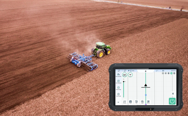
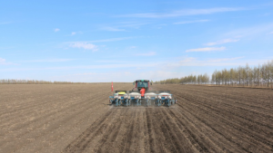
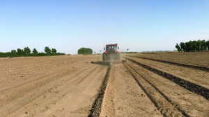
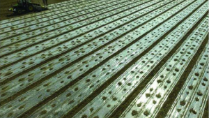
Providing advanced agricultural machinery and equipment at the forefront of innovation, our customers benefit from reduced work stress and increased productivity, resulting in higher yields and sustainable growth and profitability.
JHXH001 is a low-speed assisted driving system based on satellite positioning and body inertia to realize the system, which is mainly used in agricultural field and construction field. The technology will use the combined navigation fusion algorithm for the first time, which can eliminate the interference brought by the equipment and environment, output more accurate positioning accuracy and body compensation results, realize the precise control of the vehicle in different scenarios, ensure the operation error within 2.5 cm, and realize 24 hours uninterrupted work in day and night environment; Based on the technical advantages of combined navigation, it can meet the automatic operation under the situation of short-time GNSS signal loss. The automatic driving operation of agricultural machinery can cover the whole operation link of “cultivation, planting, management and harvesting”, solving the problem of irregular operation, reducing the labor intensity of the driver, and improving the operation efficiency and crop yield.
Self-developed combination navigation fusion algorithm greatly improves the anti-interference ability of positioning and attitude. Through data fusion, it improves the update rate and stability of data to ensure the precise control of auto-pilot automatic control technology in various operation scenarios.
It supports a variety of straight line and curve planning methods, which is more widely used; it is stronger in slope operation and soft and hard ground operation; it meets the requirements of different operation speeds, with ultra-low speed up to 0.3km/s and high speed up to more than 15km/h.
The device supports RS232, RS422, RS485, PPS, ACC, CAN, Ethernet and other interfaces, which can realize time synchronization and data interaction with other devices, and the number of some kinds of interfaces supports directional configuration;9-36V wide voltage design to meet various ways of power connection.
Remote real-time view of data, rapid guidance operation; Remote capture of operational data, rapid resolution of user issues; Support remote OTA upgrade, enjoy the features more convenient.
Support single/double antenna mode to meet the installation requirements of different vehicles; support monitor-less operation, more cost-effective; without angle sensor, more convenient to install; operation interface is simple with fewer steps, more convenient to operate.
The operation information is stored in the cloud to ensure that the user’s data is not lost; the equipment supports local storage and breakpoint renewal to ensure that the user’s operation data is not lost; it supports cell phone APP operation query to let the user pay attention to the operation information in real time; it supports the sharing of operations between the cloud and the pointing device to let the agricultural machines share the data and collaborate in the operation.
Parameter | Value |
Operating Accuracy | Dry fields: 2.5 cm (at speed ≤ 9 km/h); Rice fields: 5 cm (at speed ≤ 6 km/h) |
Operating Speed Range | 0.3 – 15 km/h |
Differential Data Source | 4G, radio station, satellite base |
Route Planning Methods | Straight-line planning, Curved-line planning |
NMEA Output Data | GGA, GSV, VTG, GSA, ZDA, RMC, GST |
Data Format | RTCM3.X |
Optional Components | Camera, Control panel with buttons, Front wheel steering angle sensor, GNSS antenna |